Industry: capturing plants without stopping production.
We capture plants, halls and underground areas with LiDAR and 360° technology — as a basis for planning, maintenance and external assessors who should not have to travel every time.
- Accuracy
- 1.9 mm at 10 m
- Deliverables
- Point cloud, tour, floor plan
- Operation
- Capture possible area by area
- Reference
- Blast furnace, mine, manufacturing
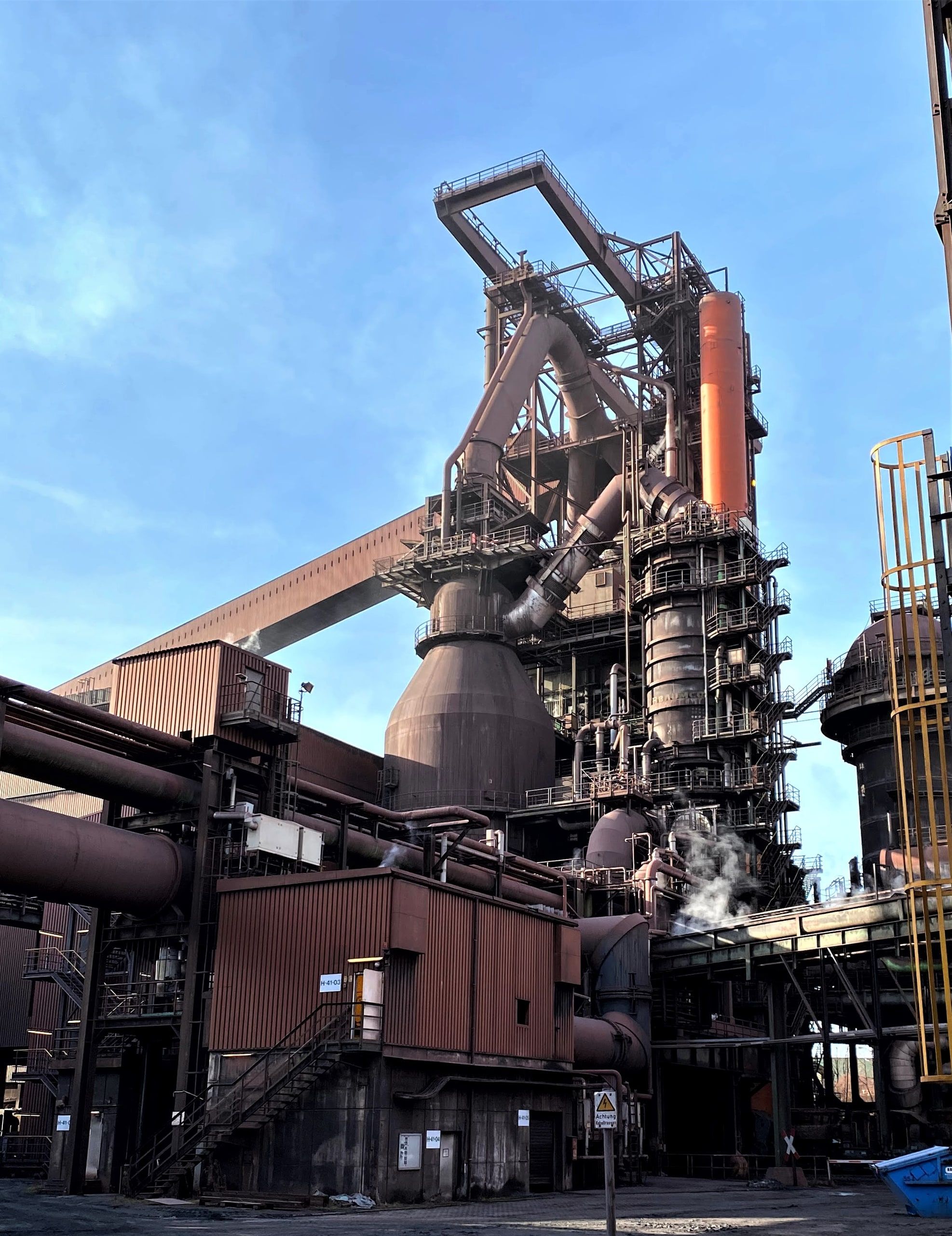
Blast furnace: one plant, many contractors
When a blast furnace at Salzgitter Flachstahl GmbH was due for relining, external contractors needed reliable dimensions of the plant. Taking each of them around the works individually, with travel, protective equipment and safety requirements, would have been laborious. So besides the furnace, the burden handling system, hot blast stoves and switch houses were captured too. More than two terabytes of scan data produced a point cloud and a tour in which the contractors could move around and measure for themselves; that is how engineers from East Asia were able to examine the plant in advance without flying in. Also captured: mines and manufacturing operations in the region.

Why industrial sites commission scans
- Planning
As-built you can rely on
Existing plans are often decades old and no longer match reality. A scan delivers the actual state — including every modification that was never documented.
- Shutdowns
Rehearsing outages in advance
When a shutdown may only last a few days, it has to be settled beforehand what goes where. In the scan, planners check installation routes, space for lifting gear and potential clashes before the first component is delivered.
- Maintenance
Checking without going there
Where does the pipe run, how much clearance is there next to the unit, how high is the platform? Maintenance answers such questions at the screen and only goes into the plant once materials and tools are settled.
- Collaboration
External parties in the model, not on site
Plant builders, assessors and suppliers walk the facility virtually and take their own measurements. Your site no longer has to handle registration, safety briefing and escort for every preliminary visit.
- Tendering
One basis for every bidder
When all bidders receive the same point cloud, you compare offers on identical data — and save yourself a site visit with each of them.
- Safety
Capturing hard-to-reach areas
Heights, narrow shafts, hot or decommissioned zones: once captured, nobody needs to enter again just to check something.
On industrial sites the capture is rarely the point in itself. Scanning happens because a tender is coming up, a plant is being modified, or an assessor needs figures nobody can state with confidence any more.
Who works with the data on site
For operators, the benefit therefore does not arise on the day of capture but in the months that follow: wherever someone would otherwise be sent out with a tape measure, a camera and a visitor badge. Maintenance checks clearances at the screen, procurement gives every bidder the same data, and occupational safety shows contractors in advance where routes, bottlenecks and restricted areas are.
For that to work, we establish before the capture who will open the data later and with which software. A planning office needs a registered point cloud in an exchange format; plant management is more likely to want a tour that runs in the browser without specialist software. Both can come out of the same visit on site, provided they are planned in from the start.
Where the data is kept
Just as important is where the data is kept. The geometry of a plant reveals a great deal about processes and capacities. For the blast furnace at Salzgitter Flachstahl GmbH, the point cloud and tour were therefore provided via a server on the intranet, reachable on the local network and not on the public internet.
If you pass data to external bidders, you can also limit its scope. Individual areas can be cropped from the overall point cloud, so each contractor receives only the part needed for their offer.
When the plant changes
A scan records the state of a single day. If the plant is modified later, the changed areas can be recaptured selectively and added to the existing point cloud; the rest of the record remains valid. That way the documentation grows with the plant instead of starting from scratch with every project.
Capture is also worthwhile for plants that are being taken out of service. Before a hall is demolished or a plant dismantled, the scan records what stood there: for demolition planning, for expert reports or as documentation of an industrial monument. One example is the former ore processing plant of Bergbau Goslar GmbH, which we captured as a tour for as-built documentation.
Frequently asked questions
Your question is not listed? Ask us directly.
What does the capture mean for ongoing operations?
Usually very little: production generally continues while we capture area by area in time windows set by your operations management. Where safety requirements apply, we agree the walkthrough with you, including briefing, escort and protective equipment. There is one limitation: moving machine parts appear blurred or incomplete in the scan. If you need the exact geometry of a machine, schedule that area for a shutdown. More in our guide to scanning during operation.
How do you handle trade secrets?
On request we hand over all raw data and delete our copies. We sign non-disclosure agreements before the walkthrough as a matter of course.
What about staff appearing in the captures?
We schedule time windows so that, as far as possible, nobody walks through the frame.
Which formats do we receive?
Point clouds in exchange formats such as E57 or XYZ, plus floor plans and sections as PDF, 3D models or BIM foundations. What matters is what your planners and your maintenance team work with. We clarify that in advance, because it determines the capture strategy.
Tour, laser scan or both?
That depends on who uses the data. For staff briefings, safety walkthroughs and giving suppliers a first orientation, a tour with measuring tools is enough. As soon as anything is designed, converted or checked for clashes, you need the exact geometry of a laser scan. On industrial projects we frequently capture both in one pass.