Municipalities and tourism: showing the place before anyone travels.
We digitize town centres, pathways and public buildings — for tourism marketing, citizen information and documentation of assets nobody wants to survey twice.
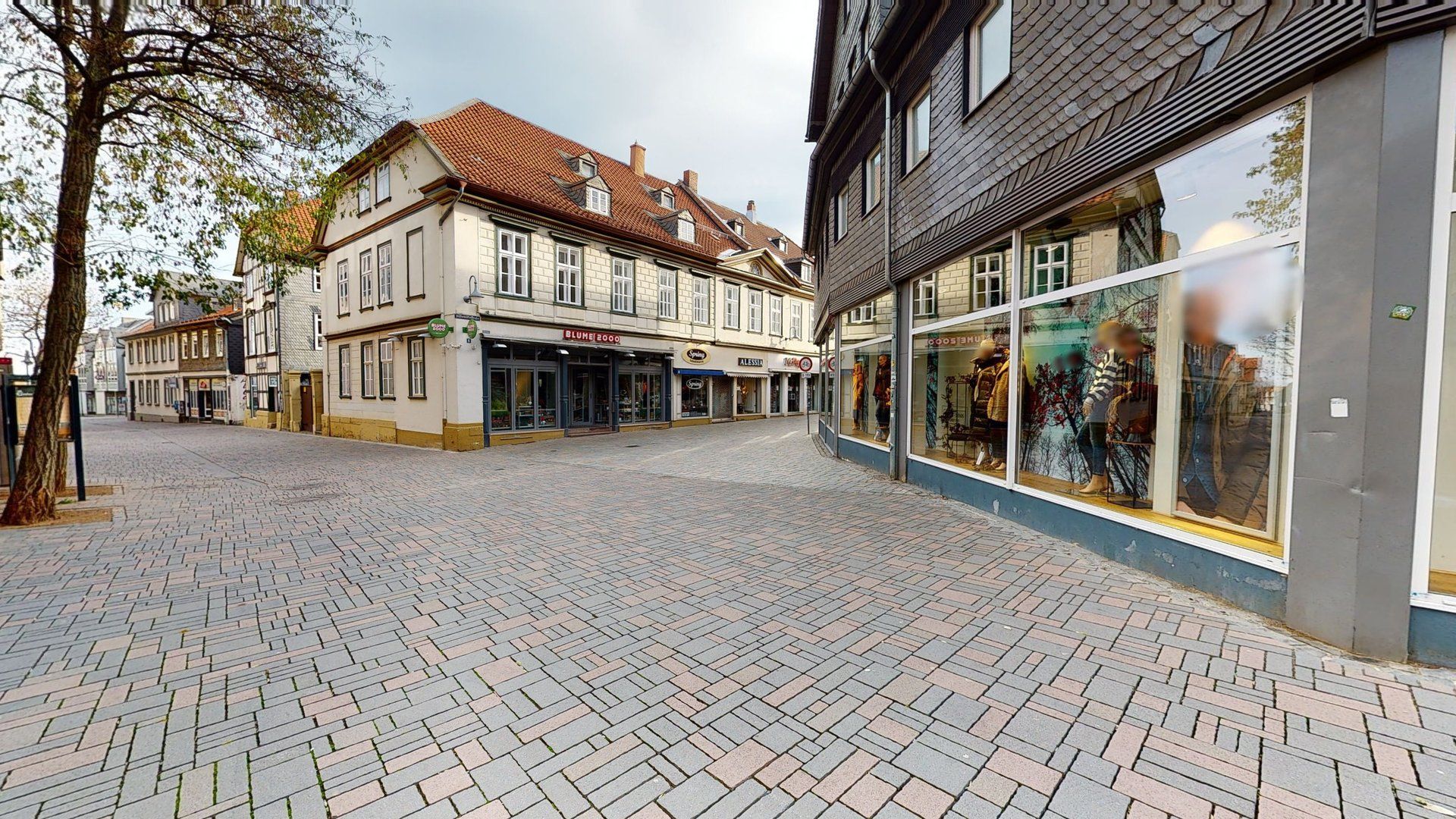
Shopping in Goslar
Goslar’s town centre as one continuous tour, from which individual shops are linked with their own 3D tours.
What municipalities do with digital twins
- Tourism
The town as a preview
People who have explored a town beforehand plan more concretely and stay longer. For towns with a historic core, that translates directly into overnight stays.
- Citizen services
Showing routes and offices
Town hall, citizens’ office, event rooms: knowing in advance which counter is where means arriving with purpose — and not asking at reception.
- Accessibility
Seeing the steps before you reach them
Town hall, public library, old-town lane: anyone using a wheelchair, a rollator or a pushchair can spot steps, ramps and lifts in the tour beforehand and plan the route accordingly.
- Coverage
Paths no mapping service knows
Pedestrian zones, parks, cemeteries, hiking trails: we capture them as blue lines for Street View.
- Assets
Documenting public buildings
Schools, sports halls, administrative buildings: a laser scan provides the planning basis for refurbishment — and remains usable as as-built documentation.
- Participation
The starting point, visible to all
When a square is to be redesigned or a building converted, the capture shows its current state. Council, administration and residents then discuss the same place, not different memories of it.
Municipal projects differ from private-sector ones in one respect: the data is often needed longer than the project runs, and by more departments than were originally involved.
That is why we clarify at the outset who will use the result later. A capture that serves both tourism marketing and property management costs little more than one for a single purpose — provided it is planned that way from the start.
Tourism: the place before the trip
In tourism, a tour works above all while a trip is being planned. Visitors see what the old town looks like, which sights are close together and how to find their way between them. Linked with Google Street View, the same capture appears where travellers are searching anyway: in Google Maps. How the two fit together is explained in the wiki entry on tourism and 360° media. The tour is also a tool at the tourist information desk: on screen, staff can show visitors how to reach their destination and what awaits them there.
One thing to bear in mind: a tour shows squares, lanes and buildings with their light and their sense of space, but not the life within them, so no weekly market and no town festival. For events, photos and videos remain the better medium. The tour answers the question of what the place looks like and how to get there.
Administration: data that lasts
For the administration, what counts is reuse. The same captures help property management with space planning, the building department with refurbishment and the managers of municipal halls with lettings. So that laser scan data is still readable years later, we deliver it in open exchange formats such as E57, which can be opened independently of any particular software. A Matterport tour stays online for as long as the hosting is renewed each year — a decision you make afresh every year.
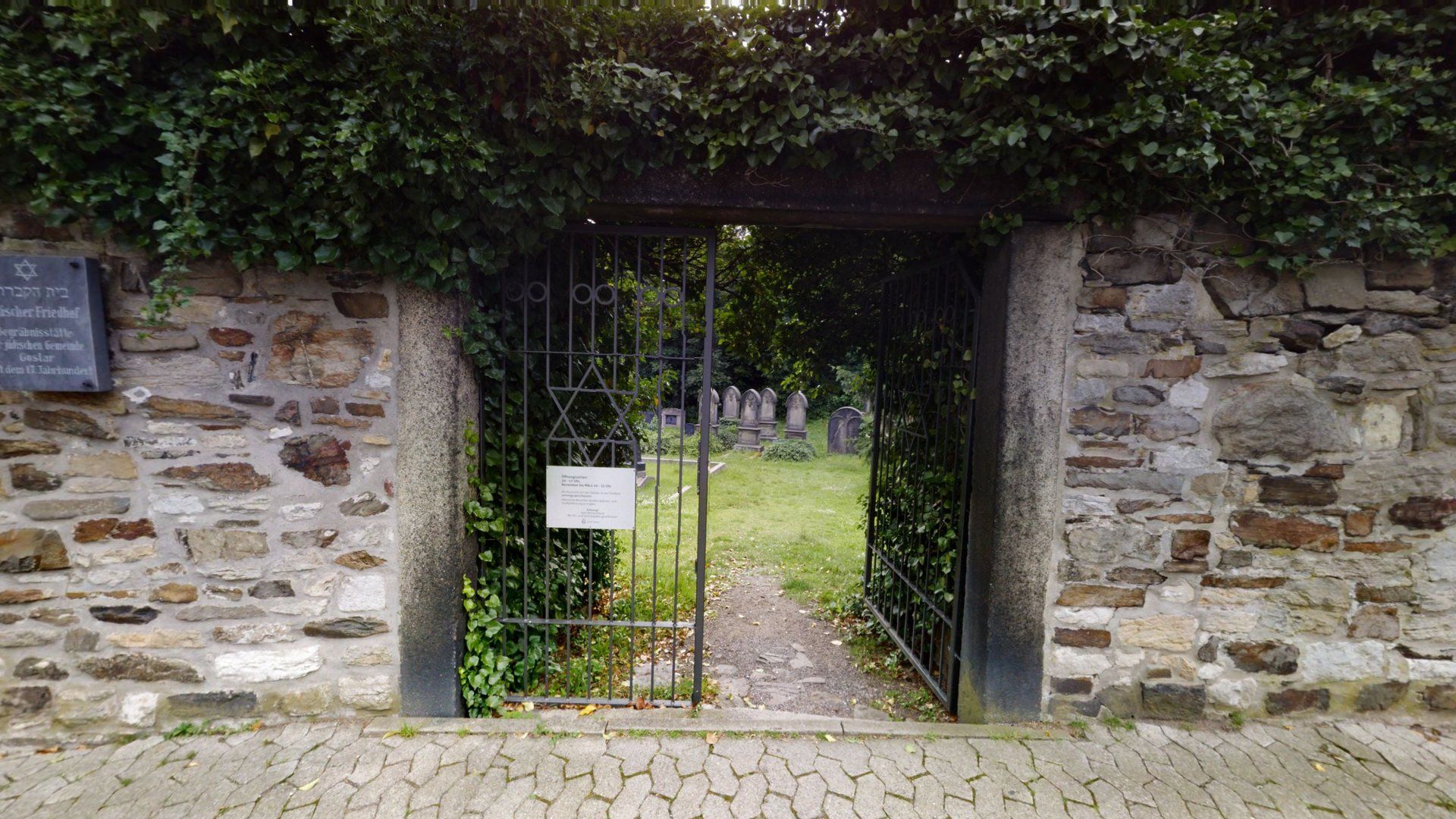
A special case is places that are not accessible at all times: memorials, cemeteries with restricted opening hours, towers or buildings under conversion. Here the capture makes permanently visible what can only be entered at certain times on site, or not at all, as with the Jewish cemetery in Goslar.
Frequently asked questions
Your question is not listed? Ask us directly.
How does data protection work for captures in public space?
People and license plates are made unrecognizable before publication. More in our guide to GDPR when capturing outdoors.
Can several departments use the same capture?
Yes, and that is usually the most economical route: one capture serves tourism marketing, property management and the building department at once. We clarify in advance which formats the different offices need.
Can this be funded through grant programmes?
Often yes — digitization, tourism and heritage programmes are all worth considering. We supply the technical specification you need for the application; the application itself stays with you or your funding advisor.
How does procurement work?
That depends on the contract value and your procurement rules. For smaller contracts you receive a written fixed-price quote that you can compare directly with other offers. For formal tenders we supply technically unambiguous specifications — even when someone else ultimately wins the contract.
How do we embed the tour on the town’s website?
With the embed code we supply. The tour runs in the browser on smartphone, tablet and PC, with no app.